Walkability is not a single feature. A neighborhood becomes easier to walk when land use, street geometry, public space, transit access, landscape, lighting, and building edges work together. This list ranks urban design ideas by how directly they improve everyday pedestrian life, especially for short daily trips, safer crossings, clearer routes, and more useful public space.
Quick Ranked Summary
- 1. Compact Mixed-Use Blocks - Land use and block structure
- 2. Pedestrian-First Street Layouts - Street hierarchy
- 3. Continuous and Wide Sidewalks - Pedestrian clear zone
- 4. Green Street Buffers - Landscape and stormwater edge
- 5. Traffic Calming Measures - Speed management
- 6. Well-Placed Public Seating and Furniture - Stay-and-pause infrastructure
- 7. Connected Public Transit Access - Mobility network
- 8. Active Ground-Floor Frontages - Building edge design
- 9. Visibility and Lighting Improvements - Comfort and perception of safety
- 10. Safe and Accessible Crossings - Intersection and crossing design
Why These Urban Design Ideas Were Selected
This ranking prioritizes public use, pedestrian safety, accessibility, implementation value, urban design clarity, adaptability, and transferability across different neighborhood types. It is not a beauty ranking or a claim that one detail fixes every street. Walkability varies by climate, maintenance, density, transit service, traffic speed, local culture, and funding, so each idea includes a caution as well as a design lesson.
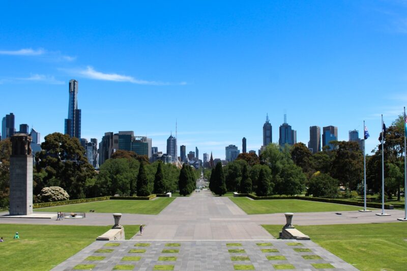
1. Compact Mixed-Use Blocks
- Scale: Land use and block structure
- Best use case: Main streets, station areas, and neighborhood centers
- Design lesson: Shorter blocks and mixed daily uses make walking practical because errands, food, services, and transit sit within a comfortable trip chain.
- Caution: Mix uses intentionally; density without shade, crossings, active edges, or loading management can still feel hostile on foot.
The most walkable neighborhoods usually begin with a simple urban pattern: smaller blocks, connected streets, and a useful mix of destinations. Housing, cafes, shops, civic uses, schools, and small workplaces do not all have to be in the same building, but they should be close enough that a person can combine trips without needing a car for every errand. This is where architecture and planning meet. Building height, ground-floor depth, frontage rhythm, entries, shade, and service access all affect whether mixed use feels lively or chaotic. The design goal is not maximum density everywhere; it is enough proximity to make walking the easiest choice for ordinary daily needs.
2. Pedestrian-First Street Layouts
- Scale: Street hierarchy
- Best use case: Downtown retail streets, school streets, waterfronts, and civic districts
- Design lesson: A street becomes walkable when walking is treated as primary movement, not leftover space after vehicle lanes.
- Caution: Pedestrian priority needs delivery plans, emergency access, accessibility details, and clear maintenance responsibilities.
Pedestrian-first design starts by asking how a person actually moves through the street: where they wait, where they cross, where they slow down, and where conflict with turning vehicles occurs. That can lead to narrower vehicle lanes, curb extensions, raised crossings, pedestrian-priority zones, car-light streets, or fully pedestrianized segments. The best versions still support businesses and operations, but they make the public realm legible from the sidewalk first. Architecture matters here because facades, entries, awnings, lighting, and transparent ground floors help define the walking experience. A pedestrian-first street is not anti-car by default; it is pro-clarity about which user is most vulnerable and most central to street life.

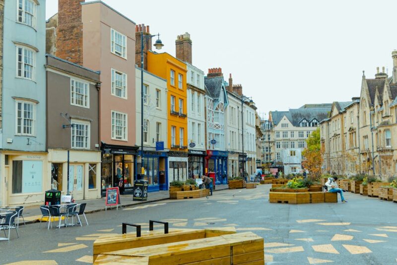
3. Continuous and Wide Sidewalks
- Scale: Pedestrian clear zone
- Best use case: Commercial corridors, transit streets, campus edges, and high-foot-traffic blocks
- Design lesson: Sidewalks work best when they provide a continuous clear path plus room for trees, lighting, doors, seating, and waiting.
- Caution: A wide sidewalk can still fail if poles, signs, outdoor dining, utilities, or curb cuts break the accessible route.
Sidewalk width is not just a dimension on a civil drawing. It determines whether two people can pass comfortably, whether someone can use a mobility device without weaving, whether a storefront can open onto the street, and whether trees or furnishings improve the walk instead of blocking it. A strong sidewalk usually has zones: building frontage, clear walking path, furnishing or planting zone, and curb interface. The clear route must remain continuous across driveways and intersections. This is where small details become urban design: curb ramps, tactile warnings, drainage, door swings, tree wells, and cafe seating all shape whether a sidewalk feels generous or improvised.
4. Green Street Buffers
- Scale: Landscape and stormwater edge
- Best use case: Residential collectors, school routes, heat-prone corridors, and retrofit streets
- Design lesson: Trees, bioswales, and planting strips can make walking cooler, calmer, and more protected while also handling stormwater.
- Caution: Planting has to preserve sight lines, accessible paths, root space, and long-term maintenance funding.
Green buffers are one of the most visible ways to make walking feel less exposed. Street trees reduce heat, planted strips separate pedestrians from moving traffic, and bioswales can turn drainage infrastructure into a civic amenity. The strongest green streets are designed as systems rather than scattered planters. They include soil volume, species selection, utilities coordination, stormwater capacity, irrigation or establishment plans, and maintenance access. In architecture terms, the landscape becomes part of the section of the street. It mediates between building frontage, sidewalk, curb, bike lane, parking lane, and travel lane. Done well, green buffers make a street safer, cooler, and more memorable at the same time.
5. Traffic Calming Measures
- Scale: Speed management
- Best use case: Neighborhood streets, school zones, main streets, and crash-prone intersections
- Design lesson: Curb extensions, raised crossings, narrow lanes, and tighter turns change driver behavior through geometry instead of relying only on signs.
- Caution: Traffic calming should be coordinated with fire access, bus movement, drainage, winter maintenance, and bicycle comfort.
Traffic calming is where safety becomes spatial. A sign may tell drivers to slow down, but geometry gives them a physical reason to do it. Narrowed crossings shorten the pedestrian exposure distance. Raised crosswalks make the crossing feel like a continuation of the sidewalk. Mini-roundabouts, chicanes, curb extensions, and tighter corner radii can reduce speed without turning a street into a wall of warning signs. The key is matching the tool to the street. A residential lane, commercial corridor, and emergency route need different details. The best projects also measure outcomes after installation because speed reduction, crash patterns, and user comfort are all part of the design brief.

6. Well-Placed Public Seating and Furniture
- Scale: Stay-and-pause infrastructure
- Best use case: Parks, plazas, retail streets, transit stops, and senior-friendly routes
- Design lesson: A walkable neighborhood needs places to stop, wait, meet, rest, and watch the street, not only paths for movement.
- Caution: Furniture should support many users without blocking access, creating hidden corners, or becoming impossible to maintain.
Walkability is not only about distance. It is also about endurance, comfort, and dignity. Benches, leaning rails, shade structures, drinking fountains, trash bins, bike racks, and lighting make longer walks possible for more people. They also give public life a place to land. Seating near storefronts, transit stops, play areas, and landscape edges supports informal social activity that no traffic model can fully capture. Placement matters more than quantity. Furniture should face something worth watching, stay clear of accessible routes, and work with shade and lighting. The strongest public realm details feel obvious after they are installed because they match how people already want to use the place.
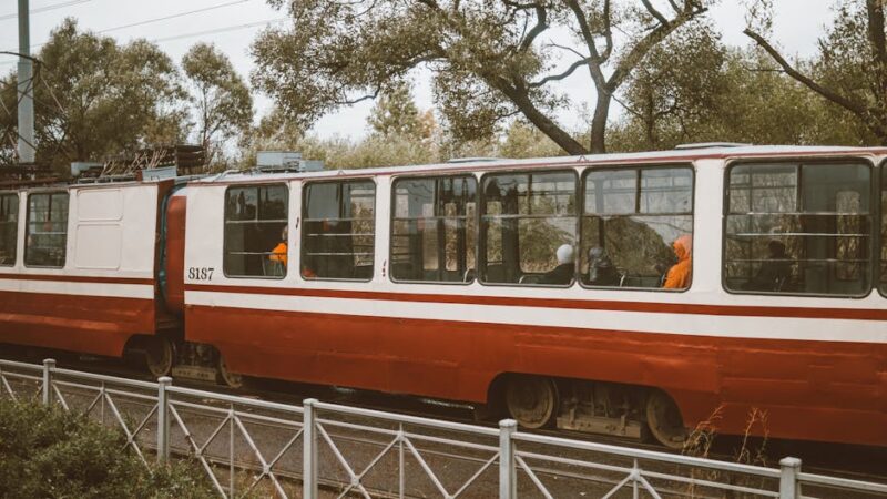
7. Connected Public Transit Access
- Scale: Mobility network
- Best use case: Transit-oriented districts, bus corridors, commuter nodes, and redevelopment areas
- Design lesson: Transit supports walking when stops are easy to reach, comfortable to wait in, and connected to safe crossings and active frontages.
- Caution: A transit stop beside a hostile arterial is not walkable just because it is technically nearby.
Transit and walking reinforce each other when the path to the stop feels safe, direct, and useful. A great station area has more than a platform. It has visible crossings, continuous sidewalks, weather protection, lighting, bike parking, wayfinding, and land uses that make the walk productive. Transit access is also a design issue for buildings. Entrances should face the walking route, blank walls should be minimized, and ground floors should support daily needs near stops. In weaker projects, transit is treated as a dot on a map. In stronger projects, transit becomes the anchor for a walkable district where the first and last five minutes of the trip are designed with care.
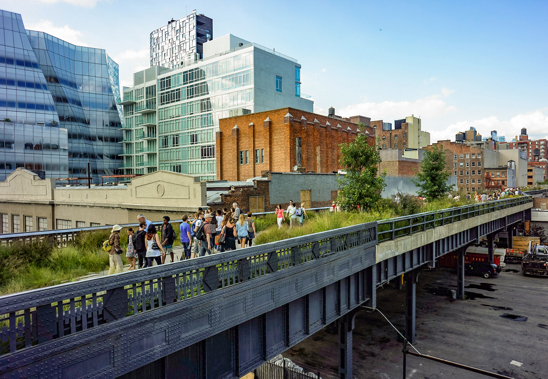
8. Active Ground-Floor Frontages
- Scale: Building edge design
- Best use case: Main streets, mixed-use corridors, plazas, and station areas
- Design lesson: Doors, windows, small bays, shade, signs, and visible activity make walking feel safer and more interesting.
- Caution: Active frontage cannot be faked with glass alone; the ground floor needs real uses, entries, depth, and management.
The edge of the building is one of the most important parts of the sidewalk. A long blank wall can make a short walk feel tedious, while a sequence of doors, windows, signs, awnings, displays, stoops, and small setbacks can make a longer walk feel natural. Active frontage does not require every block to become retail. Workshops, lobbies, community rooms, cafes, small offices, galleries, and residential entries can all contribute if they create a visible relationship between inside and outside. The design challenge is depth. Thin decorative storefronts rarely hold life. Useful ground floors need ceiling height, flexible bays, service access, and enough transparency to make the street feel observed and inhabited.
Source: Global Designing Cities Initiative street design guidance
9. Visibility and Lighting Improvements
- Scale: Comfort and perception of safety
- Best use case: Transit walks, alleys, underpasses, parking edges, and evening commercial streets
- Design lesson: Good lighting supports facial recognition, clear routes, and visible edges without blasting glare into homes or sidewalks.
- Caution: Lighting should be paired with active uses and maintenance; brightness alone does not create a good public realm.
Lighting is often treated as an engineering afterthought, but it shapes whether a street works after sunset. Pedestrian-scale lighting can help people read surfaces, identify routes, see other users, and navigate intersections. The goal is not to flood every block with harsh light. Better lighting controls glare, avoids deep contrast, respects nearby residences, and highlights the places where decisions happen: crossings, steps, transit stops, entries, and edges. Visibility also includes trimming landscape, maintaining sight lines, avoiding hidden recesses, and keeping ground-floor uses active. A walkable neighborhood should feel legible in the evening, not transformed into a different and less welcoming place.

10. Safe and Accessible Crossings
- Scale: Intersection and crossing design
- Best use case: Schools, transit stops, senior housing, commercial streets, and trail connections
- Design lesson: Crossings are the test of a walkable network because every broken curb ramp, long wait, or wide turn interrupts the pedestrian trip.
- Caution: Crossing upgrades need signal timing, drainage, tactile cues, refuge space, visibility, and turning-speed control to work together.
A neighborhood can have attractive sidewalks and still fail at the intersection. Safe crossings require a complete chain of details: ramps aligned with the crosswalk, detectable warnings, refuge islands where needed, signal timing that works for slower walkers, daylighting near corners, and turning geometry that discourages fast vehicle movement. Crossings also decide whether transit stops, schools, parks, and shops are truly accessible. Designers should read intersections as public rooms, not just traffic devices. The best crossings make the desired pedestrian path obvious, direct, and comfortable. They reduce ambiguity for drivers and remove small barriers that quietly exclude children, older adults, and people using mobility devices.

Related Architecture Adrenaline Reads
Frequently Asked Questions
What is the fastest way to make a neighborhood more walkable?
The fastest improvements usually come from crossings, traffic calming, shade, seating, and closing small gaps in the sidewalk network. Larger gains come when those fixes are paired with mixed-use zoning and transit access.
Do walkable neighborhoods require high-rise density?
No. Density helps support transit and local businesses, but walkability depends on connected streets, nearby destinations, safe crossings, useful ground floors, and comfortable public space. Many low-rise main streets are highly walkable.
How should cities choose which walkability upgrades come first?
Start with routes used by children, older adults, transit riders, and people walking to daily needs. Crash history, missing sidewalks, high vehicle speeds, long crossings, and heat exposure are practical signals for prioritizing investment.
Further Reading & Source References
- EPA Smart Growth
- NACTO Urban Street Design Guide
- U.S. Access Board public right-of-way guidance
- NACTO Urban Street Stormwater Guide
- FHWA Proven Safety Countermeasures
- Project for Public Spaces placemaking guidance
- ITDP TOD Standard
- Global Designing Cities Initiative street design guidance
- AARP Livable Communities resources
- FHWA pedestrian and bicycle safety resources